

Certified Photogrammetrist Practice Test
Updated October 2026Facts verified Oct 31, 2026 against American Society for Photogrammetry and Remote Sensing
Photogrammetry is a specialized field within geospatial science that involves deriving precise measurements and spatial data from photographs. As technology advances and the demand for high-precision mapping grows, the need for qualified professionals in photogrammetry is on the rise. Achieving the Certified Photogrammetrist designation, awarded by the American Society for Photogrammetry and Remote Sensing (ASPRS), is a significant credential for professionals in this field. The certification confirms a photogrammetrist’s expertise in capturing, analyzing, and interpreting aerial and satellite imagery to produce accurate maps and 3D models used in various sectors, from environmental conservation to urban planning.
- The Certified Photogrammetrist exam, as a Certified Mapping Scientist exam, lasts no longer than 4 hours.[1]
- The ASPRS initial certification application fee for the Certified Photogrammetrist credential is $300 for ASPRS members, with a separate Prometric testing fee.[1]
- The ASPRS initial certification application fee for the Certified Photogrammetrist credential is $495 for non-members, with a separate Prometric testing fee.[1]
- Applicants retaking the Certified Photogrammetrist exam must pay Prometric for the second testing appointment.[1]
- Approved Certified Photogrammetrist applicants may take the exam twice, with the retake due within 6 months of the first attempt and a new application with fees required after a second failure.[1]
- ASPRS certifications, including Certified Photogrammetrist, are valid for five years.[1]
- Certified Photogrammetrist recertification is required every five years, requires 100 PDHs, and costs $200 for ASPRS members or $400 for non-members.[1]
- The Certified Photogrammetrist exam is computer-based through Prometric, either at a Prometric testing facility or with an online web-based proctor.[1]
- Certified Photogrammetrist applicants need six years of photogrammetry experience, three of them in a position of professional responsibility, plus four references and a written exam.[1]
Numbers in brackets link to the official sources listed under Sources & last verified. Dates that have passed are removed automatically.
Certified Photogrammetrist Exam at a Glance
| Item | Detail | Source · Verified |
|---|---|---|
| Time limit | Up to 4 hours[1] | American Society for Photogrammetry and Remote Sensing · Oct 24, 2026 |
| Exam fee (Initial certification application (ASPRS member)) | $300 (member), plus Prometric testing fee[1] | American Society for Photogrammetry and Remote Sensing · Oct 24, 2026 |
| Exam fee (Initial certification application (non-member)) | $495 (non-member), plus Prometric testing fee[1] | American Society for Photogrammetry and Remote Sensing · Oct 24, 2026 |
| Exam fee (Prometric testing fee) | Charged separately by Prometric (amount not published in the manual)[1] | American Society for Photogrammetry and Remote Sensing · Oct 24, 2026 |
| Retake fee | Applicant pays Prometric for the second testing appointment[1] | American Society for Photogrammetry and Remote Sensing · Oct 24, 2026 |
| Retake policy | Two attempts per approval; retake within 6 months; re-apply after a second failure[1] | American Society for Photogrammetry and Remote Sensing · Oct 24, 2026 |
| Validity | 5 years[1] | American Society for Photogrammetry and Remote Sensing · Oct 24, 2026 |
| Renewal | Recertify every 5 years: 100 PDH, 4 references; $200 member / $400 non-member[1] | American Society for Photogrammetry and Remote Sensing · Oct 24, 2026 |
| Delivery | Computer-based at a Prometric test center or online web-based proctor[1] | American Society for Photogrammetry and Remote Sensing · Oct 24, 2026 |
| Eligibility | 6 years' photogrammetry experience (3 in responsible position), 4 references, Code of Ethics declaration[1] | American Society for Photogrammetry and Remote Sensing · Oct 24, 2026 |
| Registration opens | Schedule with Prometric only after ASPRS approves your application[2] | prometric.com · Oct 24, 2026 |
According to American Society for Photogrammetry and Remote Sensing, “Six years of experience in photogrammetry, three years of which were in a position of professional responsibility”[1]
Certified Photogrammetrist content outline and where to practise each area
The content areas below are copied from the official Certified Photogrammetrist content outline published by American Society for Photogrammetry and Remote Sensing, with the share of the exam each area carries. The right-hand column shows which of our practice sets covers it.
| Official content area | Weight | Practice on this site |
|---|---|---|
| Earth Science[3] | 8% | Certified Photogrammetrist Geodesy & Map P... Practise datums, ellipsoids, coordinate systems and map projections, including how Earth-fixed frames are defined. |
| Engineering/Surveying[3] | 8% | Certified Photogrammetrist Surveying Princ... Work through leveling, control surveys and error handling until the arithmetic is routine. |
| Lidar[3] | 5% | Certified Photogrammetrist Digital Photogr... Review how point clouds are collected, classified and checked against control. |
| Mathematics[3] | 10% | Certified Photogrammetrist Aerial Triangul... Practise least squares, adjustment concepts and the matrix reasoning behind triangulation. |
| Photogrammetry[3] | 41% | Certified Photogrammetrist Photogrammetric... Plan flights, overlap, scale and ground sample distance, then move on to stereo compilation and product generation. |
| Physics[3] | 6% | Certified Photogrammetrist Camera Calibrat... Review optics, lens distortion, sensor geometry and the light behaviour behind imaging. |
| Professional/Ethical[3] | 7% | Certified Photogrammetrist Quality Control... Learn accuracy standards and reporting practice, and read the ASPRS Code of Ethics itself. |
| Remote Sensing[3] | 5% | Certified Photogrammetrist Remote Sensing ... Practise spectral signatures, image interpretation and the basics of multispectral sensors. |
Certified Photogrammetrist Practice Test Questions
Prepare for the Certified Photogrammetrist exam with our free practice test modules. Each quiz covers key topics to help you pass on your first try.
Certified Photogrammetrist Aerial Triangul...
Certified Photogrammetrist Exam Questions covering Aerial Triangulation & Bundle Adjustment. Master Certified Photogrammetrist Test concepts for certification prep.
Certified Photogrammetrist Camera Calibrat...
Free Certified Photogrammetrist Practice Test featuring Camera Calibration & Sensor Geometry. Improve your Certified Photogrammetrist Exam score with mock test prep.
Certified Photogrammetrist Digital Photogr...
Certified Photogrammetrist Mock Exam on Digital Photogrammetry & Point Clouds. Certified Photogrammetrist Study Guide questions to pass on your first try.
Certified Photogrammetrist Photogrammetric...
Certified Photogrammetrist Mock Test covering Photogrammetric Product Generation. Online Certified Photogrammetrist Test practice with instant feedback.
Worked examples: how to reason through Certified Photogrammetrist questions
These are practice questions written for this site, not questions from the real exam. Each explanation shows why the right answer is right and why the others are wrong.
Example 1
Question: Under the ASPRS Positional Accuracy Standards, Non-vegetated Vertical Accuracy (NVA) at the 95% confidence level is computed as:
- 1.7308 x RMSEz
- 1.96 x RMSEz
- The 95th percentile of errors
- 3 x RMSEz
Answer: B. 1.96 x RMSEz
Explanation:
The correct answer is 1.96 x RMSEz. The ASPRS standard reports Non-vegetated Vertical Accuracy at the 95% confidence level, and it assumes the errors are normally distributed. Under that assumption, the 95% level is 1.96 times the root mean square error.
1.7308 x RMSEz is the multiplier for a horizontal circular error, so it belongs to a different measure. The 95th percentile of errors is a method the standard uses for vegetated areas, where errors are not assumed to be normal. 3 x RMSEz does not correspond to the 95% level.
Rule to remember: the statistic depends on the error distribution. Normal errors use a multiplier on RMSE, and non-normal errors use a percentile.
Example 2
Question: In an Earth-Centered, Earth-Fixed (ECEF) Cartesian system, the X-axis points toward which location?
- The conventional North Pole
- The intersection of the equator and the prime meridian
- The intersection of the equator and 90 degrees E
- The vernal equinox
Answer: B. The intersection of the equator and the prime meridian
Explanation:
The correct answer is the intersection of the equator and the prime meridian. In an Earth-Centered, Earth-Fixed system the origin sits at the center of mass of the Earth, and the X-axis passes through that point on the surface, at zero latitude and zero longitude.
The conventional North Pole is where the Z-axis points, not X. The intersection of the equator and 90 degrees E is the direction of the Y-axis, which completes a right-handed system. The vernal equinox is the reference for an inertial frame, which does not rotate with the Earth, so it is not the ECEF X direction.
Rule to remember: ECEF rotates with the Earth, so its axes are tied to the surface, not to the stars.
Example 3
Question: In differential leveling, a benchmark has an elevation of 100.00 ft, the backsight on it is 4.25 ft, and the foresight on a new point is 2.10 ft. What is the elevation of the new point?
- 97.85 ft
- 106.35 ft
- 104.25 ft
- 102.15 ft
Answer: D. 102.15 ft
Explanation:
The correct answer is 102.15 ft. A backsight is a reading on a point of known elevation, so it is added to that elevation to get the height of instrument: 100.00 + 4.25 = 104.25 ft. A foresight is a reading on a new point, so it is subtracted: 104.25 - 2.10 = 102.15 ft.
97.85 ft comes from subtracting the backsight and then also subtracting the foresight, which uses the wrong sign for the backsight. 106.35 ft adds both readings. 104.25 ft is the height of instrument, which stops before the foresight is applied.
Rule to remember: add the backsight, subtract the foresight. A backsight looks back at known ground, and a foresight looks forward to new ground.
How to use these practice tests
Start with the official material. Read the current ASPRS certification manual so you know the eligibility rules, the fee table and the retake terms, and look at the published content areas so you know where the weight sits.
Next, take one practice set from the list above with no notes, for a baseline. Mark each miss by cause: a formula you forgot, a concept you misread, or a unit slip. Sets that mostly show concept gaps need reading before more questions. Sets that show slips need more timed practice.
Spend the most time on the Photogrammetry area, since it carries the largest share of the outline, and keep your weaker sets in rotation. Return to a set a few days after your first attempt, and write out the reasoning for each answer instead of recognising the option.
Do the arithmetic by hand for leveling, scale and adjustment questions. Learn the accuracy standards and the Code of Ethics in the source documents, since our questions are written by us and are not real exam questions.
In the last days before the test, do a mixed run across all sets under a time limit, and check the Prometric arrangements for your chosen test center or online proctor.
Key Takeaways
Free Photogrammetrist Practice Test Online
- High Demand: Certified photogrammetrists are in demand across industries like government, engineering, and environmental science.
- Lucrative Career: With the certification, professionals can access higher salaries and more advanced job opportunities.
- In-Depth Knowledge Required: The test requires extensive knowledge of photogrammetry principles, software tools, and analytical techniques.
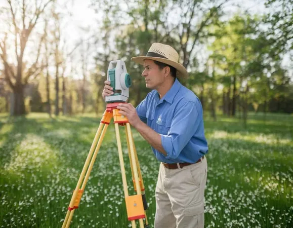
What is a Certified Photogrammetrist?
A (Certified Photogrammetrist) is a professional skilled in creating detailed, accurate maps and models from aerial images and other geospatial data. Certified by the American Society for Photogrammetry and Remote Sensing (ASPRS), the credential signifies a high level of expertise in photogrammetry, a branch of science focused on obtaining measurements and 3D spatial data from photographs. This certification ensures professionals are well-versed in methods that support industries like construction, engineering, and environmental management.
Photogrammetry is pivotal in today’s geospatial landscape, with leveraging images, software, and analytical techniques to develop accurate spatial representations used in mapping, urban planning, and land management.
- Utilizing aerial and satellite imagery to create high-precision maps and 3D models
- Analyzing geographic data to support planning and development projects
- Collaborating with GIS specialists, surveyors, and urban planners
Responsibilities and Job Description of a Photogrammetrist
Photogrammetrists play a crucial role in the fields of geospatial science, cartography, and land surveying. Their expertise is indispensable for accurately mapping and modeling large geographical areas.
Core Responsibilities:
- Data Collection: Gathering and processing aerial imagery and other geospatial data to create maps and 3D models
- Image Analysis: Using specialized software to analyze and interpret photographic data, making adjustments for scale, rotation, and lens distortions
- 3D Modeling: Creating and refining 3D representations of geographic areas, which serve as critical resources for urban planning, environmental studies, and construction projects
- Collaboration: Working closely with professionals from related fields, such as surveyors, geographers, and environmental scientists
- Quality Assurance: Ensuring high accuracy in spatial data, which is crucial for projects where precision is critical, such as infrastructure development
Career Opportunities for Photogrammetrists
Certified Photogrammetrist can explore a wide range of career paths across industries, including:
- Government Agencies: Many federal, state, and local agencies hire photogrammetrists to assist with land management, urban planning, and environmental conservation efforts. Agencies like the U.S. Geological Survey (USGS) often employ photogrammetrists to develop mapping systems and conduct geographical surveys.
- Private Sector: Engineering firms, construction companies, and environmental consulting firms are among the many private organizations that rely on photogrammetrists to create accurate spatial data. They play a key role in projects involving site development, urban planning, and environmental assessments.
- Academic and Research Institutions: Many universities and research centers employ photogrammetrists to advance spatial analysis and contribute to fields like archeology, environmental studies, and climate science.
Salary Expectations for Photogrammetrists
The average salary for a photogrammetrist varies by location, experience level, and industry. Certified photogrammetrists generally earn higher salaries due to their advanced qualifications and specialized skills.
- Entry-Level: Entry-level photogrammetrists can expect an average salary ranging from $50,000 to $65,000 per year.
- Mid-Level to Experienced: With several years of experience and certification, mid-level photogrammetrists typically earn between $65,000 and $85,000 per year.
- Senior-Level: Highly experienced photogrammetrists or those in managerial positions may earn upwards of $90,000, especially if working for major engineering firms or government agencies.
The certification can positively impact earning potential, as certified professionals are recognized for their expertise and credibility in the field, making them more attractive to employers.
Preparing for the Test: Key Information
Becoming a Certified Photogrammetrist involves passing the test, a rigorous exam that assesses an individual's knowledge of photogrammetry concepts, software, and analytical techniques.
Eligibility Requirements:
- A minimum of four years of experience in photogrammetry or a related field is typically required to qualify for the exam.
- Candidates should have a solid understanding of aerial imagery analysis, 3D modeling, geospatial data management, and related technical skills.
Exam Content: The test covers a wide range of topics, including:
- Fundamentals of Photogrammetry: Principles of remote sensing, image interpretation, and 3D mapping
- Data Processing Techniques: Knowledge of software tools and methodologies for refining aerial images
- Analytical Skills: Understanding of scale, resolution, and other variables critical to creating accurate geospatial data

Study Resources:
- ASPRS Handbook: A valuable study resource for candidates, detailing the principles, practices, and standards in photogrammetry.
- Workshops and Seminars: ASPRS and various academic institutions offer specialized workshops to help candidates prepare for the exam.
- Practice Exams: Sample questions and practice tests can help candidates familiarize themselves with the exam format and identify areas for improvement.
Conclusion
A Certified Photogrammetrist credential opens doors to a rewarding career in geospatial science, enabling professionals to work on crucial projects across multiple industries. With the right training and experience, certified individuals can make significant contributions to infrastructure development, urban planning, and environmental conservation. This certification not only enhances career prospects but also builds credibility and expertise that are highly valued in the workforce.
- +Validates your knowledge and skills objectively
- +Increases job market competitiveness
- +Provides structured learning goals
- +Networking opportunities with other certified professionals
- −Study materials can be expensive
- −Exam anxiety can affect performance
- −Requires dedicated preparation time
- −Retake fees apply if you don't pass
Certified Photogrammetrist Questions and Answers
Sources & last verified
- American Society for Photogrammetry and Remote Sensing — time limit, exam fee, retake fee, retake policy (official source). “no longer than 4 hours for Certified Mapping Scientist (including Certified Photogrammetrist)” Verified Oct 24, 2026.
- prometric.com — registration opens (official source). “Candidates for the ASPRS exam may not schedule unless they have received application approval from the ASPRS.” Verified Oct 24, 2026.
- American Society for Photogrammetry and Remote Sensing — other (official source). “earth science 8%” Verified Nov 1, 2026.
How we verify: editorial & fact-checking policy. Report an error: contact us.
How this page was made: written with AI tools and published by Nathan Beja, founder of Practice Test Geeks, who is responsible for its content. Exam facts are checked against the official sources listed below. Not reviewed by a subject-matter expert. Editorial policy
Sources & references
Exam facts on this page (fees, format, dates, passing scores) are checked against these official sources; the date is our last check. Editorial policy
- asprs.org — Test delivery, eligibility, fees, renewal, retake fee, retake policy, time limit, score validity, exam information · verified Nov 2026
- prometric.com — Registration · verified Oct 2026