FAA Flight Operations Test 2
This is a timed quiz. You will be given 60 seconds per question. Are you ready?
60
How many satellites make up the Global Positioning System (GPS)?
Correct!
Wrong!
When the course deviation indicator (CDI) needle is centered using a VOR test signal (VOT), the omnibearing selector (OBS) and the TO/FROM indicator should read
Correct!
Wrong!
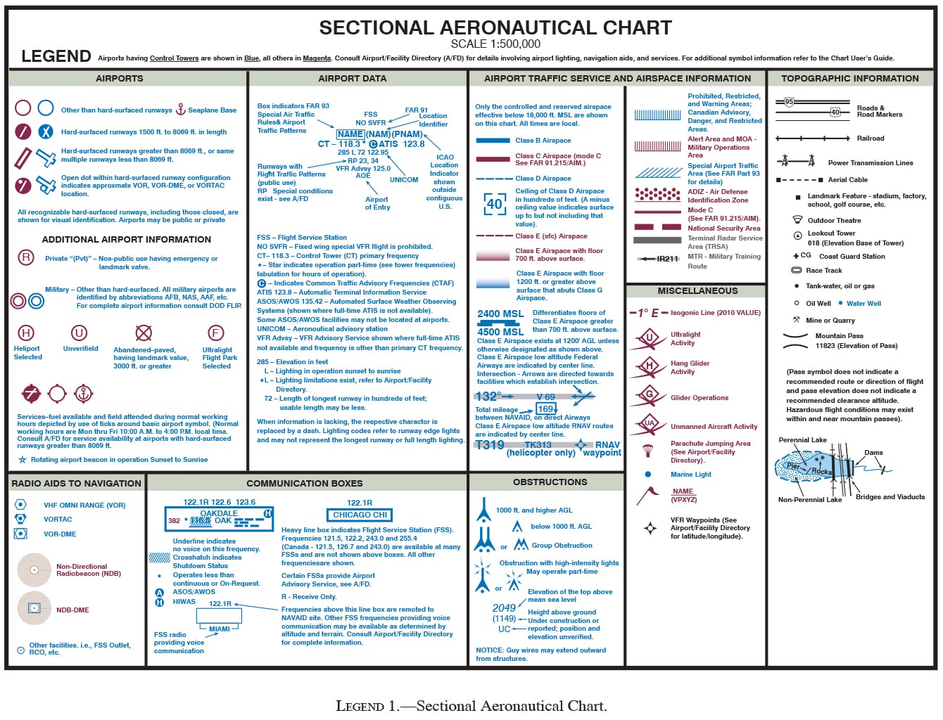
(Refer to Legend 1) Which of the symbols depicted with a hexagon represents a VOR-DME?
Correct!
Wrong!
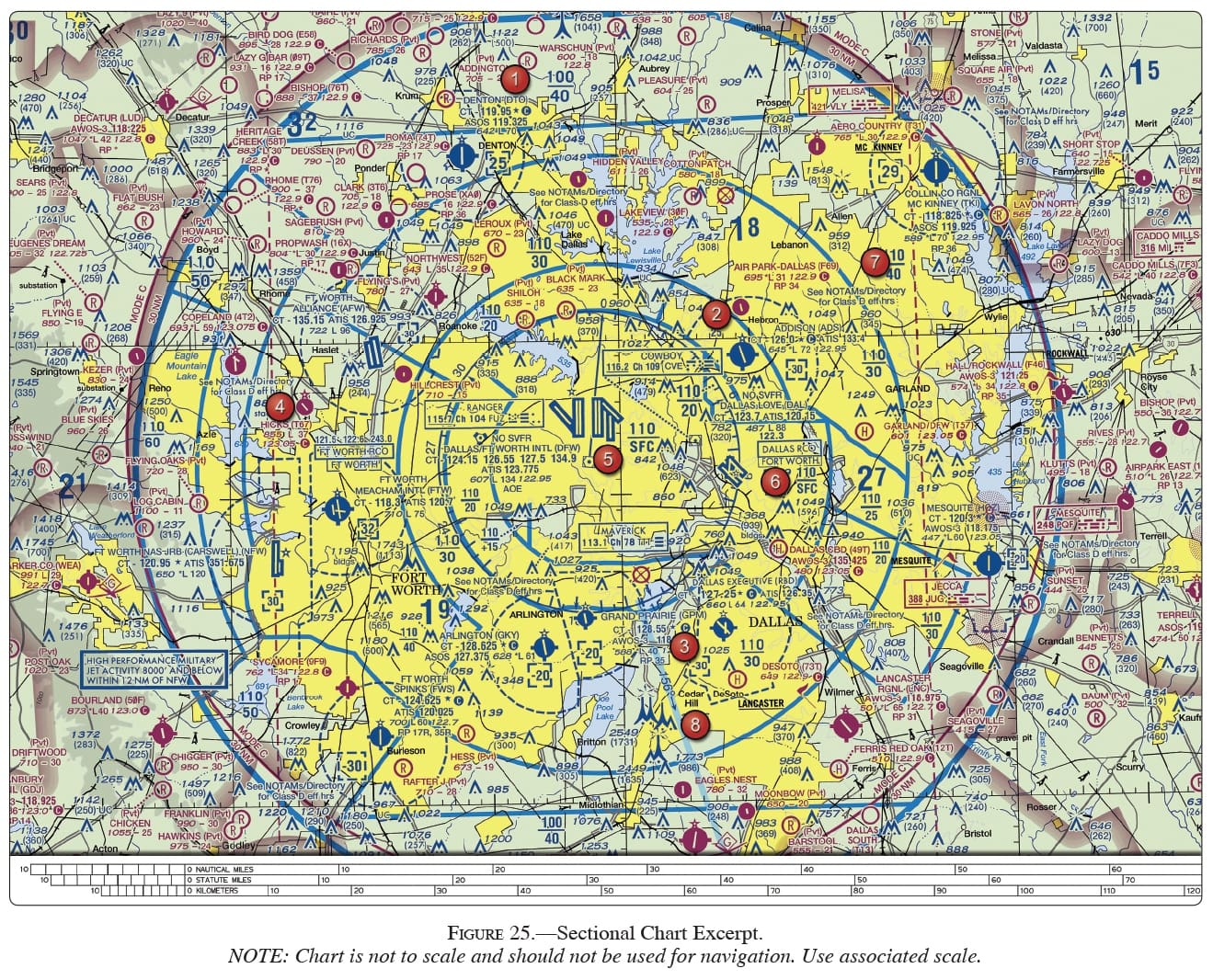
(Refer to Figure 25, area 5.) The VOR is tuned to the Ranger VORTAC. The omnibearing selector (OBS) is set on 256°, with a TO indication, and a left course deviation indicator (CDI) deflection. What is the aircraft’s position from the VORTAC?
Correct!
Wrong!
(Refer to Legend 1) A VORTAC station is represented by
Correct!
Wrong!
Can a GPS be used as an altimeter?
Correct!
Wrong!
What is the minimum number of Global Positioning System (GPS) satellites that are observable by a user anywhere on earth?
Correct!
Wrong!
(Refer to Figure 25, area 5.) The navigation facility at Dallas-Ft. Worth International (DFW) is a
Correct!
Wrong!
How many Global Positioning System (GPS) satellites are required to yield a three dimensional position (latitude, longitude, and altitude) and time solution?
Correct!
Wrong!
If Receiver Autonomous Integrity Monitoring (RAIM) capability is lost in-flight,
Correct!
Wrong!
(Refer to Legend 1) What symbol would indicate a VORTAC location on an airport?
Correct!
Wrong!