

CST Practice Test
Updated for October 2026The Certified Survey Technician (CST) credential, sponsored by the National Society of Professional Surveyors (NSPS), is designed to recognize the skills and knowledge of technicians working in the surveying field. This credential not only validates competency but also opens doors to more job opportunities and career advancement. As industries increasingly rely on precise mapping and measurement data, certified professionals are in higher demand.
Whether you're just beginning your career in land surveying or looking to validate years of experience, the CST exam is a key stepping stone. This guide provides a comprehensive overview of what it means to be a survey technician, how to become one, salary expectations, and how to find opportunities in the field.
Free CST - Certified Survey Technician Study Tools
Interactive CST - Certified Survey Technician resources on PracticeTestGeeks, free to start:
- CST - Certified Survey Technician flashcards — review key terms and concepts card by card
- CST - Certified Survey Technician study guide — topic-by-topic overview of what the exam covers
- CST - Certified Survey Technician cheat sheet — one-page printable summary for last-minute review
CST Practice Test Questions
Prepare for the CST - Certified Survey Technician exam with our free practice test modules. Each quiz covers key topics to help you pass on your first try.
CST Code Compliance
CST Exam Questions covering Code Compliance. Master CST Test concepts for certification prep.
CST Legal Descriptions & Boundary Surveys
Free CST Practice Test featuring CST Legal Descriptions & Boundary Surveys. Improve your CST Exam score with mock test prep.
CST Survey Documentation & Records
CST Mock Exam on CST Survey Documentation & Records. CST Study Guide questions to pass on your first try.
CST Environmental Standards
CST Test Prep for Environmental Standards. Practice CST Quiz questions and boost your score.
CST Equipment Operation
CST Questions and Answers on Equipment Operation. Free CST practice for exam readiness.
CST Field Procedures & Data Collection
CST Mock Test covering Field Procedures & Data Collection. Online CST Test practice with instant feedback.
CST GPS & GNSS Surveying Technologies
Free CST Quiz on GPS & GNSS Surveying Technologies. CST Exam prep questions with detailed explanations.
CST Maintenance Protocols
CST Practice Questions for Maintenance Protocols. Build confidence for your CST certification exam.
CST Mapping & Platting Techniques
CST Test Online for Mapping & Platting Techniques. Free practice with instant results and feedback.
CST Material Selection
CST Study Material on Material Selection. Prepare effectively with real exam-style questions.
CST Quality Inspection
Free CST Test covering Quality Inspection. Practice and track your CST exam readiness.
CST Safety Procedures
CST Exam Questions covering Safety Procedures. Master CST Test concepts for certification prep.
CST Standards, Ethics & Safety Practices
Free CST Practice Test featuring Standards, Ethics & Safety Practices. Improve your CST Exam score with mock test prep.
Key Takeaways
Free CST Practice Test Online
The Certified Survey Technician (CST) credential enhances credibility and opens up career opportunities.
Survey technicians work both in field and office environments to support licensed surveyors in land measurement and mapping tasks.
The path to certification includes education, field experience, and passing the CST exam offered by the NSPS.
Salaries for survey technicians vary, but certification generally improves earnings and job prospects.
Demand for survey technicians is rising due to infrastructure expansion, environmental planning, and GIS integration.
Understanding the Role of a Survey Technician
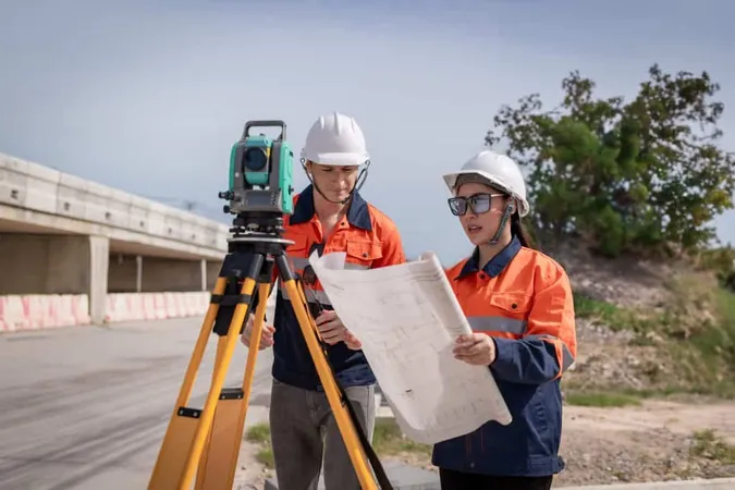
A survey technician is a professional who supports licensed surveyors in collecting, analyzing, and preparing geographic and topographic data. They play a vital role in construction, mapping, and land development projects.
Key responsibilities include:
Assisting with field surveys using GPS, total stations, and other equipment
Preparing maps, plats, and reports based on field data
Operating CAD software to produce survey drawings
Ensuring accurate and legal boundary descriptions
Collaborating with engineers, architects, and planners
Technicians can work in offices or out in the field depending on the project phase and their specialization.
What Is the Path to Becoming a Survey Technician?
Becoming a survey technician typically involves a blend of education, technical skills, and hands-on experience. The CST program provides a structured pathway through four levels—each with increasing difficulty and responsibility.
Steps to becoming a Certified Survey Technician:
Education
While a degree isn’t always required, many employers prefer candidates with an associate’s degree in geomatics, civil engineering technology, or a related field. Community colleges and technical institutes often offer these programs.
US Department of Education: Career and Technical Programs
Gain Field Experience
Hands-on training is critical. Many technicians begin their careers through internships or entry-level roles where they learn to operate surveying tools and interpret data.
Certification Through NSPS
The CST exam offers four levels (Level I to IV), with Level I focusing on entry-level knowledge and Level IV covering project management and supervision.
More info: NSPS CST Program Overview
Continuing Education
Staying current with new tools, regulations, and software is essential. Ongoing training can lead to more senior positions or specialization in areas like hydrographic or geodetic surveying.
What Does a Survey Technician Do Daily?
Daily duties can vary based on project type and career level, but most CSTs perform both technical and administrative tasks that support the land surveying process.
Typical responsibilities include:
Collecting geographic data through on-site surveys
Interpreting and verifying legal land records
Using GPS and GIS systems to plot accurate maps
Managing equipment calibration and maintenance
Assisting in project documentation and submission to regulatory bodies
Their work helps prevent costly errors in construction, land sales, and infrastructure development. For government-related projects, accurate land surveys are vital to zoning and environmental planning.
Salary Expectations for Survey Technicians
If you're considering a career as a survey technician, salary is an important factor. According to the U.S. Bureau of Labor Statistics, the median annual wage for surveying and mapping technicians was $47,820 as of 2026.
Factors influencing salary include:
Location – Urban areas and states with higher infrastructure spending often pay more
Experience – Technicians with higher CST levels or specialized skills earn significantly more
Employer type – Working for government agencies, private engineering firms, or construction companies impacts earnings
Certifications – Holding a CST credential increases salary potential and job security.
Finding Survey Technician Jobs Near You
With the rise in urban development, land-use planning, and environmental monitoring, survey technicians are increasingly in demand across the country.
Best ways to find opportunities include:
Job Boards
Use job search engines like USAJobs.gov or local government portals to explore current openings.
USAJobs.govProfessional Associations
NSPS, American Congress on Surveying and Mapping, and other organizations often post job listings and host networking events.Local Engineering Firms
Reach out directly to civil engineering or land surveying firms, especially those working on municipal or infrastructure projects.LinkedIn and Networking
Building a professional network in geomatics and land surveying increases your visibility and access to job leads.

Conclusion
Earning a CST certification is a smart career move for anyone interested in geography, technology, and the built environment. Whether you're just starting or looking to formalize years of experience, the Certified Survey Technician program provides the structure and recognition you need to grow in the surveying profession.
With opportunities expanding in both public and private sectors, certified technicians are well-positioned to thrive in a competitive job market. Take the first step today by exploring local training options and preparing for your CST exam.

CST: Pros and Cons
- +CST certification validates expertise recognized by employers nationwide
- +Certified professionals typically earn 15-20% higher salaries
- +Opens doors to advanced positions and leadership roles
- +Demonstrates commitment to professional standards and ethics
- +Builds a strong professional network through certification communities
- −Exam preparation typically requires 2-4 months of dedicated study
- −Certification and exam fees can range from $150-$500+
- −Must complete continuing education to maintain active certification
- −Pass rates vary — thorough preparation is essential for success
- −Some certifications require prerequisite experience or education
Pros and Cons at a Glance
| Pros | Cons |
|---|---|
| CST certification validates expertise recognized by employers nationwide | Must complete continuing education to maintain active certification |
| Opens doors to advanced positions and leadership roles | Pass rates vary — thorough preparation is essential for success |
| Demonstrates commitment to professional standards and ethics | Some certifications require prerequisite experience or education |
Sample CST - Certified Survey Technician Practice Questions
Try these questions from our free CST - Certified Survey Technician practice tests. The correct answer and an explanation follow each question.
Which GPS survey method produces the highest accuracy for establishing control points?
- A. Real-Time Kinematic (RTK)
- B. Static differential GPS with post-processing
- C. Single-point autonomous positioning
- D. WAAS-corrected navigation GPS
Answer: B. Static differential GPS with post-processing
Static differential GPS, where two or more receivers simultaneously collect data for extended sessions, achieves sub-centimeter accuracy through rigorous post-processing that eliminates most systematic error sources.
Why is continuing education important for survey professionals?
- A. To get more vacation time
- B. To increase billing rates
- C. To remain competent and current
- D. To impress clients
Answer: C. To remain competent and current
Continuing education is vital for survey professionals to stay abreast of new technologies, evolving regulations, and best practices in the field. The surveying profession is dynamic, with advancements in GPS, LiDAR, and software constantly emerging. Ongoing learning ensures that surveyors maintain their competence, deliver high-quality services, and meet licensing requirements.
Why must survey data be verified in the field?
- A. To meet government quotas
- B. To reduce field trips
- C. To correct on-site errors immediately
- D. To match drone data only
Answer: C. To correct on-site errors immediately
Verifying survey data in the field allows surveyors to identify and correct any measurement errors or discrepancies while still on site. This immediate correction prevents the propagation of errors into subsequent measurements and avoids costly return trips to the field. It ensures the accuracy and reliability of the collected data.
In a survey plat, what does a 'legend' provide?
- A. A historical narrative about the property
- B. Explanations of symbols, abbreviations, and line types used on the drawing
- C. The legal description of the parcel
- D. The surveyor's certification statement
Answer: B. Explanations of symbols, abbreviations, and line types used on the drawing
A plat legend defines all symbols, abbreviations, and linework conventions used in the drawing so the plat can be correctly interpreted by anyone reading it.
Take the full CST - Certified Survey Technician practice test
(CST) Certified Survey Technician Questions and Answers
About the Author

Certified Professional Development Expert & Niche Certification Advisor
University of Pennsylvania Graduate School of EducationDr. Alexandra Kim holds a PhD in Professional Studies from the University of Pennsylvania and is a Certified Professional in Learning and Performance (CPLP) and Certified Professional in Talent Development (CPTD). With 17 years of corporate training and professional certification advisory experience, she helps professionals navigate specialized, emerging, and cross-industry certification programs.