FAA Cameras: Airport Surveillance, Weather Cams & Public Webcams 2026 July
FAA cameras explained — weather cams, airport surveillance, public webcams at WeatherCams.faa.gov, and NTSB investigation footage. 🏆
If you've ever wondered what those grainy mountain pass views on aviation forums actually are, you're looking at the FAA Weather Camera Program — and it's one of the quieter success stories in modern aviation safety. The program started small. Alaska, late 1990s, where a single missed cloud bank could end badly for a bush pilot threading a valley with no instrument approach for hundreds of miles.
Forecasts were vague. Pilot reports were sparse. So the FAA bolted cameras to remote sites and started streaming. The first installations weren't fancy — basic CCTV units, satellite uplinks, batteries trickle-charged by solar panels in places where maintenance crews could only reach them by helicopter or float plane.
That experiment grew. Today the network sits at over 230 sites across Alaska alone, plus Hawaii, the Pacific Northwest, and Montana — and the public-facing portal at WeatherCams.faa.gov gets traffic from every direction. Pilots use it for preflight. Dispatchers cross-reference it with METARs. Search and rescue teams use the archive to reconstruct conditions during the window of an overdue aircraft. And honestly? A lot of curious aviation enthusiasts just browse it. The cameras have developed an unexpected secondary audience among hikers, fishing guides, and remote-area residents who just want a daily look at the weather where the highway ends.
But "FAA cameras" is a slippery term. People use it to mean five different things — weather cams, airport surveillance, drone airspace monitoring, NTSB crash investigation footage, even commercial webcam feeds that happen to point at runways. They're not all the same thing, and they don't all belong to the FAA.
Some are public infrastructure. Some are private security. Some exist in a regulatory gray zone that nobody really wants to talk about. We'll sort it out, piece by piece, so you walk away knowing exactly which camera does what — and which agency to call if you have a question about any of them.

FAA Weather Camera Program by the Numbers
The numbers above tell a story most people miss. When the FAA published its retrospective on the Alaska Weather Camera Program in 2018, the safety data was hard to argue with — weather-involved general aviation accidents on routes covered by the camera network dropped sharply. Not because the cameras predicted weather. They didn't. They just showed it. A pilot in Anchorage could look at the Rainy Pass camera and see, in actual photographs taken minutes ago, whether the pass was open. No interpretation needed. No reading between the lines of an obscure forecast discussion. Just a picture.
That simplicity is why the program expanded. Hawaii joined first, mostly to cover the inter-island routes where weather can shift dramatically over short distances. Then the Pacific Northwest with its mountain corridors — Cascade passes, the Olympic Peninsula's marine layer, the Columbia Gorge with its notorious wind funneling.
Montana came online to cover the Rockies and the more remote stretches where GA traffic is heavy and weather stations are sparse. The FAA never marketed it loudly, but the user base grew through word of mouth — pilots telling other pilots, flight instructors building lessons around it, dispatchers checking it before clearing departures.
What's worth noting is that the program's success owes a lot to one specific design choice — keeping it free and unrestricted. Plenty of government safety initiatives wrap themselves in registration walls, terms-of-use clickthroughs, or commercial licensing schemes. The FAA went the other way. No login. No paywall. No restriction on redistribution. That decision turned the camera network into something pilots actually used, rather than something they avoided because the access friction was higher than the value.
What "FAA Cameras" Actually Means
When pilots say FAA cameras, they usually mean the Weather Camera Program — government-funded, FAA-operated, free to view. When airport managers say it, they often mean perimeter and ramp surveillance, which is typically owned by the airport authority or TSA, not the FAA itself. And when news outlets use the phrase after an incident, they're sometimes talking about NTSB-retrieved footage from any nearby camera, public or private. Three different things. One confusing label.
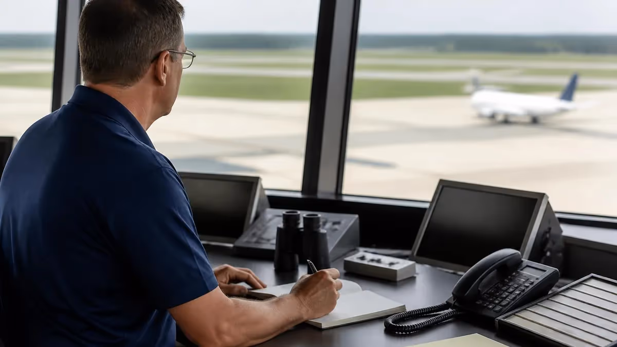
Worth pausing on that distinction, because it trips up a lot of people studying for their FAA exams. The agency itself owns and operates a fairly narrow slice of the camera infrastructure you'll find at or near American airports. Most of what you see — security cameras at TSA checkpoints, ramp cameras watching baggage handlers, perimeter fencing cams — those belong to airport authorities or contractors.
The FAA's direct camera footprint is mostly weather observation, navigational aids, and a handful of air traffic control tower exterior cameras used for situational awareness. There's also a small fleet of cameras used at FAA-run facilities like the Mike Monroney Aeronautical Center in Oklahoma City, but those are facility security, not flight operations.
For the practical pilot, this matters because if you're filing a complaint about being filmed on a ramp, you're probably not filing it with the FAA. And if you're requesting weather camera imagery for a flight review, you're going to the FAA's public portal, not to Homeland Security. The agencies have very different missions, very different legal authorities, and very different procedures for handling records requests. Mixing them up wastes time and frustrates everyone involved.
The FAA's official position, restated in several advisory circulars, is that weather cameras are supplemental — they don't replace official weather products like METARs, TAFs, or AIRMETs. They're meant to add visual confirmation to those products, not stand in for them. That's a regulatory subtlety worth remembering on exam day. If a checkride examiner asks how you'd plan a VFR flight into marginal conditions and you answer with weather cams alone, you're probably going to fail that line item. The right answer involves official products first, cams second as visual confirmation.
Where FAA Cameras Show Up
Public-access cameras at remote sites, refreshed every 10 minutes, archived for 24 hours. Free at WeatherCams.faa.gov. Used by pilots, dispatchers, hikers, and curious citizens.
Limited use at some ATC towers for visual scanning beyond line-of-sight from the cab. Not publicly accessible. Footage retained per facility policy.
Experimental at Leesburg (KJYO) and others. Cameras replace the physical tower view, feeding controllers at a remote facility. FAA-certified, growing slowly.
Not FAA. Owned by airport authority, TSA, or private contractors. Covers ramps, gates, perimeters, parking. Subject to airport-specific privacy and retention rules.
After accidents, the NTSB requests footage from any nearby camera — FAA weather cams, airport surveillance, traffic cams, private security. Useful for flight path reconstruction.
Separate program. FAA partners with detection vendors to monitor restricted airspace via ground-based optical and radar sensors. Not weather cams, not public-facing.

Here's where it gets interesting for anyone preparing for the FAA private pilot weather test or working through a commercial syllabus. The weather camera network is treated by examiners and check airmen as a legitimate planning resource — but only when used correctly. Showing up at an oral exam and saying "I checked the Rainy Pass cam, it looked clear" without also citing the area forecast is going to draw a follow-up question. The cameras supplement. They don't replace. That's a phrase worth memorizing because it shows up almost verbatim in FAA advisory material.
That said, the cameras do something forecasts can't: they show you the current state of the sky. A TAF might say "VFR with scattered clouds at 6,000." The camera might show actual cloud bottoms scraping the ridgeline at what looks like 2,000 feet AGL. Those two data points together are way more useful than either alone. The TAF tells you what the forecaster expected. The cam tells you what's actually happening. Reconciling the two is the judgment skill that separates safe pilots from statistics.
One thing examiners particularly like to probe is the question of when a pilot should distrust a forecast in favor of cam evidence. The answer isn't "always trust the cam" — sometimes the cam is showing a momentary cloud that doesn't represent overall conditions. The answer is closer to "when cam evidence is consistent with PIREPs, surface observations, and your own visual scan from departure, weight it heavily." Aviation decision-making is never about one data source. It's about triangulating across many.
How Each Camera Type Is Used
Open WeatherCams.faa.gov in any browser. Search by site name, region, or route. Each site shows the most recent image (timestamped), plus an archive going back 24 hours. Compare the live image against the latest METAR for that station. Look for cloud bases, visibility cues, snow on terrain, and lighting conditions.
Most experienced Alaska pilots check multiple cams along their route — departure airport, midpoint pass, destination. Time-lapse view shows weather trends, not just snapshots.
The drone piece deserves more attention than it usually gets. Since the proliferation of consumer UAS, the FAA has invested heavily in detection — not because every drone is a threat, but because identifying which ones are operating legally (under Part 107) versus which ones aren't has become genuinely difficult. Cameras and radar working together can pinpoint a drone's location and altitude, then cross-reference against authorized LAANC operations to flag anomalies. When a drone appears in controlled airspace without a corresponding LAANC authorization, that's the signal that triggers law enforcement coordination.
Most major airports now have some level of drone detection. Smaller GA fields don't. That gap is closing slowly, partly through FAA grants and partly through state-level initiatives. If you're working through the Part 107 study materials, expect this topic to keep growing in regulatory relevance. The cameras involved here are nothing like weather cams — they're high-resolution, often infrared-capable, and feed real-time into detection algorithms that can classify objects as drones, birds, or aircraft. The whole stack is built for security, not visibility.
FAA weather cameras are positioned to show terrain, sky conditions, and runways — not people. They're low-resolution by design, refresh slowly, and typically don't capture identifiable individuals. Airport surveillance is different. Those cameras are high-resolution, continuous, and intentionally focused on people and vehicles. If you're working in the AOA, your employer's privacy policy applies, not the FAA's. Know which camera you're under before you assume anything about privacy.
Let's talk about access — because this is one area where the FAA gets serious credit for being unusually open. WeatherCams.faa.gov requires no login, no application, no commercial license. You don't have to be a pilot. You don't have to register. The whole archive is free, the imagery is in the public domain, and the FAA explicitly encourages redistribution for safety purposes. Try doing that with most federal datasets and see how far you get before someone asks for an institutional affiliation.
Compare that to airport surveillance footage, which generally requires a subpoena, a FOIA request (for federally operated facilities), or a formal incident report. The retention windows are shorter and the request process more demanding. Most airports won't release footage to anyone except law enforcement or insurance investigators with a documented claim. Even then, the process can take weeks, and footage older than the retention window — usually 30 to 90 days at most facilities — is simply gone. Auto-deletion is the default. That's why time-sensitive requests matter so much.
The contrast matters because it reflects the very different missions of the two systems. Weather cams exist to be seen. Surveillance cams exist to deter and document. One is publicity-driven, the other is privacy-driven. Treating them the same will get you nowhere in practical terms — different agencies, different request processes, different timelines, different legal frameworks.

Using FAA Weather Cams Effectively
- ✓Always cross-reference cam imagery with the current METAR for that station — they should agree.
- ✓Check the timestamp on every image. A 30-minute-old picture in a fast-changing weather system is nearly useless.
- ✓Review the 24-hour archive to see weather trends, not just the current snapshot.
- ✓Compare daytime cams against expected sun angle — heavy shadows can hide cloud bases.
- ✓Look at multiple cams along your route, not just departure and destination.
- ✓Remember the FAA classification — supplemental information, not a substitute for official forecasts.
- ✓If a cam is offline or shows "image unavailable," don't assume the weather is fine — assume you need another data source.
- ✓Note any seasonal limitations — some remote cams have reduced reliability in extreme cold or storms.
The checklist above isn't theoretical. Every item on it traces back to an actual incident report where a pilot misused, misread, or over-relied on a weather camera image. The most common failure mode is the timestamp — pilots glance at an image, see clear conditions, and don't realize they're looking at something taken 45 minutes ago in weather that changed dramatically since. NTSB investigators have documented this pattern repeatedly, and the FAA has updated its guidance materials specifically to address it.
There's also the lighting issue, which is more subtle. In Alaska especially, sun angles in winter create deep shadows that can completely hide weather features. A pass that looks clear on a 2 PM cam image might have a 1,500-foot ceiling that the camera literally can't capture because of the shadow geometry. Experienced Alaska pilots know to interpret cam images differently in December than in June. The same applies in mountain regions of the Lower 48 — winter low-sun angles change what the cam can show, in ways that aren't obvious unless you know what to look for.
Camera reliability is another failure mode. In extreme conditions — heavy snow, prolonged freezing rain, sustained high winds — cams can fail outright or freeze on the last good image. The FAA's portal flags stale images, but pilots in a hurry sometimes miss the flag. A frozen image showing yesterday afternoon's conditions is worse than no image at all, because it creates a false sense of having checked. The professional habit is to verify the timestamp every single time and never skip that step.
FAA Weather Camera Pros and Cons
- +Free, public access — no login or qualification required
- +Visual confirmation that supplements text-based weather products
- +Coverage in remote areas where METARs are sparse or absent
- +24-hour archive lets you see weather trends, not just snapshots
- +FAA-validated camera placement based on accident history and route demand
- +Public domain imagery — usable in training, presentations, and reports
- −Refresh rate of 10 minutes can miss fast-moving weather changes
- −Resolution is intentionally low — fine detail is often unavailable
- −Cameras can go offline in extreme conditions, exactly when you need them most
- −Lighting, shadow, and seasonal effects can hide real weather features
- −Coverage gaps still exist — most of the Lower 48 isn't covered
- −Not a legal substitute for official weather products on a flight plan
One thing that doesn't get said enough — the FAA's weather camera program is one of the rare federal initiatives that started small, proved itself with data, and expanded methodically. It didn't try to cover everywhere at once. It targeted the routes where accident data showed the biggest safety gap, deployed cameras, measured outcomes, and used those outcomes to justify expansion. That's a model worth studying for anyone interested in aviation safety policy. The lesson translates well to other domains where evidence-based deployment beats glossy promises.
The future of the program looks busy. Hawaii's network is still growing. Mountain corridors in Wyoming and Colorado are under evaluation. And there's quiet discussion about whether select GA-heavy regions in the Lower 48 — parts of New Mexico, Idaho, northern California — might justify deployment. Funding is the limiter, not technology. Cameras have gotten cheaper, satellite uplinks more reliable, and solar power more practical even in marginal sun conditions. The constraint is now mostly about budgets and which routes have accident histories strong enough to justify the line item.
For students working through cross-country planning exercises, integrating weather cam review into the workflow is good practice — not because the exam will ask you specifically about WeatherCams.faa.gov, but because the planning habit of looking at actual current sky conditions alongside predicted conditions is exactly the kind of judgment that examiners are probing for. The cameras are a tool. The skill is knowing when, how, and why to use them. Most flight schools now include cam review in their pre-solo cross-country curriculum, especially in regions with mountain terrain or coastal effects.
Eventually, all of this will be more automated. Imagery analysis software is already crunching weather cam data into machine-readable observations. Some commercial flight planning apps pull cam thumbnails directly into the route briefing. The FAA is testing AI models that flag cam images showing conditions worse than the corresponding METAR — a kind of automated sanity check on official weather products.
None of that replaces a pilot looking at a picture and making a judgment, though. That part stays human for now, and probably for a long time after — because the responsibility for go/no-go decisions sits with the pilot in command, not the software.
The bigger takeaway from all of this is that "FAA cameras" isn't one thing. It's a constellation of overlapping camera systems, owned by different agencies, governed by different rules, used for different purposes. Sorting them out is the first step. Using them effectively — particularly the weather camera network — is the second.
And recognizing that they're tools, not authorities, is the third. Get those three right and you'll handle camera-related questions on any FAA written or practical exam with confidence. And more importantly, you'll bring a sharper eye to your real flight planning — which is the actual point of every safety system the FAA builds, cameras included.
If you take only one thing away from this overview, make it this — bookmark WeatherCams.faa.gov, check it during every preflight that touches mountain or coastal terrain, and treat the imagery as one input among several. The pilots who get the most out of the network are the ones who've built it into a habit. The ones who learn its limitations the hard way are the ones who treated it as either too important or not important enough. Aim for the middle. The cameras reward attention without demanding worship.
FAA Questions and Answers
About the Author
Commercial Pilot & FAA Certification Specialist
Embry-Riddle Aeronautical UniversityCaptain Jennifer Walsh graduated with honors in Aerospace Engineering from Embry-Riddle Aeronautical University and holds FAA Airframe & Powerplant and Airline Transport Pilot certificates. With 11 years of commercial aviation experience and 6 years as a ground school instructor, she guides aviation mechanics and student pilots through FAA written exams and practical tests.
Join the Discussion
Connect with other students preparing for this exam. Share tips, ask questions, and get advice from people who have been there.
View discussion (5 replies)