FREE NAEP Geography Grade 8 Questions and Answers
Which of the following bioregions(biomes) do the dark-shaded areas of the map represent?
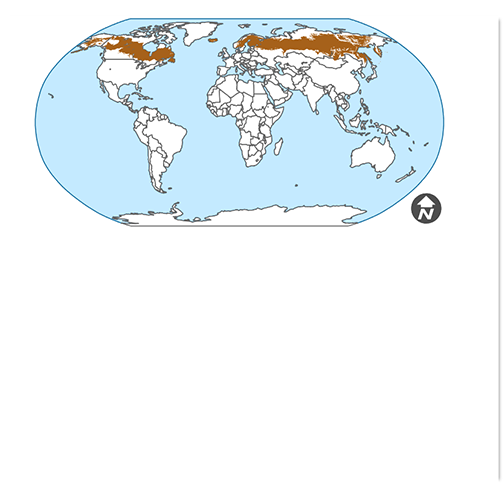
Correct!
Wrong!
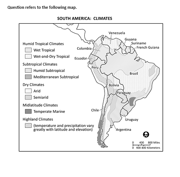
What type of vegetation would you anticipate to find in Brazil's northwest?
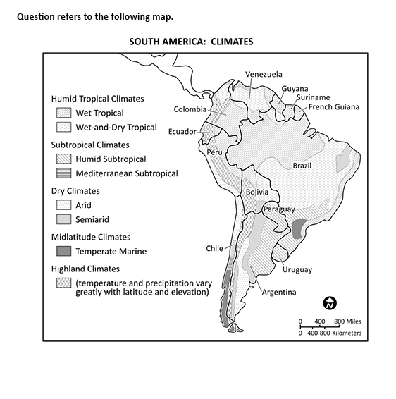
Correct!
Wrong!
View the diagram. The earth's axis' tilt directly influences the
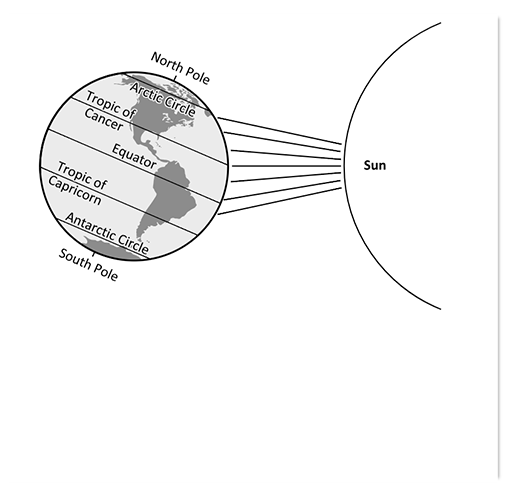
Correct!
Wrong!
Study the four locations on the map that have numbers. Which location has the highest temperature year-round?
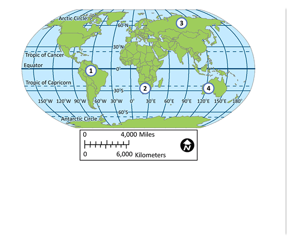
Correct!
Wrong!
In which of the following regions is a tornado the most likely to occur?
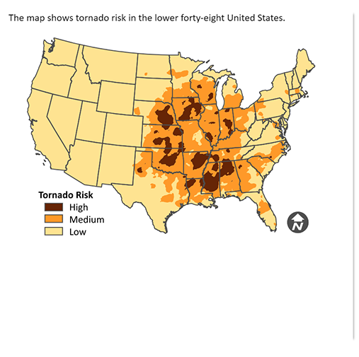
Correct!
Wrong!
Which crops only thrive in a tropical environment?
Correct!
Wrong!
These plants are typically cultivated in tropical regions. Originating in tropical regions with warm temperatures and high humidity, cocoa beans are the primary ingredient in chocolate. Bananas and papayas are also tropical fruits that require warm temperatures and abundant rainfall to thrive.
The country with the driest climates among the options listed is
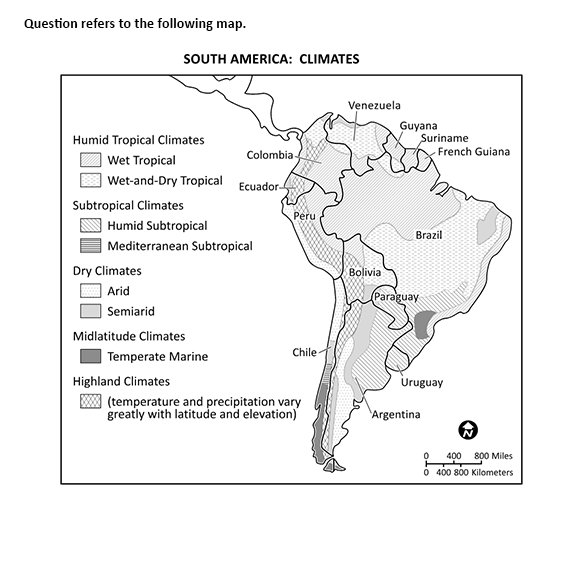
Correct!
Wrong!
What significant positive impact does the summer monsoon have on India's economy?
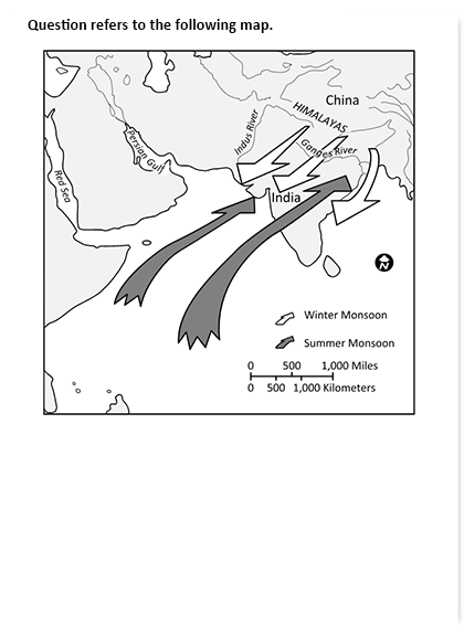
Correct!
Wrong!
The water cycle benefits from solar heat because it causes
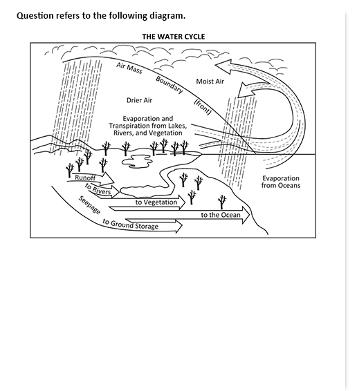
Correct!
Wrong!
Which of the following statements accurately describes South Sudan's location?
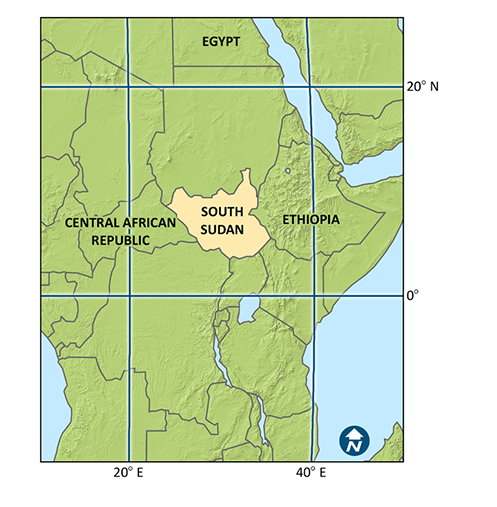
Correct!
Wrong!
According to the map, which of the following Illinois regions has the greatest population density?
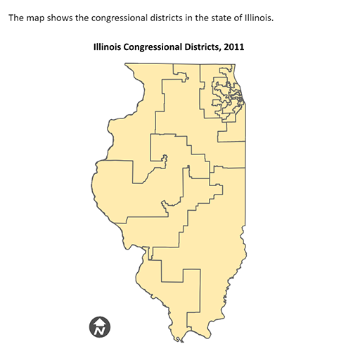
Correct!
Wrong!
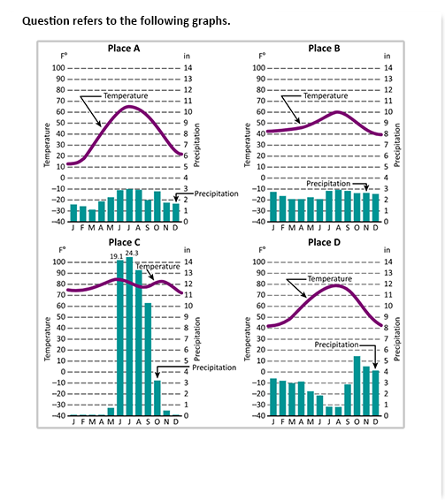
Which location has the biggest difference in average temperature between the warmest and coldest months of the year, according to the four climate graphs?

Correct!
Wrong!
Which of the following statements best describes this landscape's characteristics?
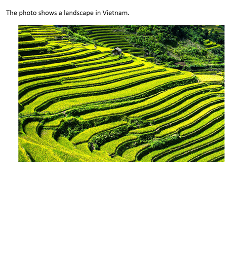
Correct!
Wrong!
The terrain depicted on the temperature map is likely a
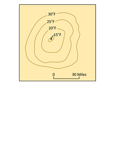
Correct!
Wrong!
The climate of Uruguay, Paraguay, Argentina, and southern Brazil is most comparable to that of which region of the United States?
Correct!
Wrong!
Climate-wise, Place C's climate-like city is
Correct!
Wrong!